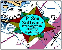
Charts are made in layers so that any item on the charts can be turned on or off so you can reduce clutter if needed.
Charts are available in C-Map C-cards, CD's or download from the internet.

![[IMAGE]](button_h.jpg) Back to P-Sea Software Home page
Back to P-Sea Software Home page
![[IMAGE]](mail.jpg) webinfo@p-sea.com
webinfo@p-sea.com


Program available now: P-Sea WindPlot MAX, P-Sea WindPlot MAX 3D and P-Sea WindView MAX using C-Map MAX Charts
The new P-Sea WindPlot MAX has all the
same features as P-Sea WindPlot II AND it will be
compatible with C-Map MAX charts.
FEATURES: (Click to see sample)
Perspective View
Sizable Print and icons
Night Colors:
Depth Highlighting
Currents
Built in Photos of Landmarks
Tides

![[IMAGE]](button_h.jpg) Back to P-Sea Software Home page
Back to P-Sea Software Home page
![[IMAGE]](mail.jpg) webinfo@p-sea.com
webinfo@p-sea.com