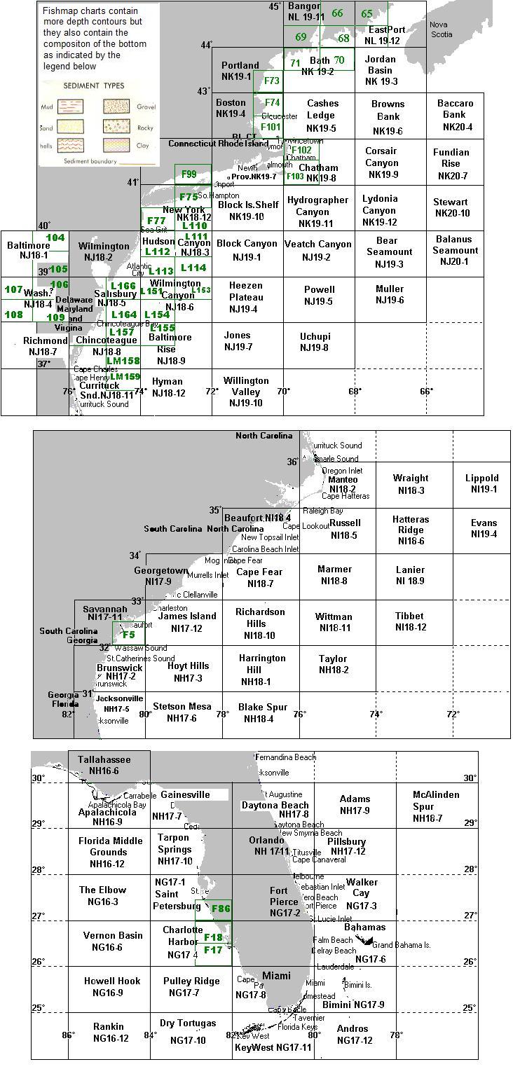
All chart #’s in green have a scale of 1:100,000 and cover 1 degree of Longitude and half degree of Latitude. The rest have a scale of 1:250,000. They are in black covering 2 degrees of Longitude and 1 degree of Latitude. Chart #’s in green that start with “F” are considered FISHMAPS. They are in color, have bottom characteristics. Chart #’s in green that have a “L” in front are in black & white with Loran-C overlay. Chart #’s in green with no letters in front are uncompleted bathy. charts with some written bottom detail and in black & white


![[IMAGE]](button_h.jpg) Back to P-Sea Software Home page
Back to P-Sea Software Home page ![[IMAGE]](mail.jpg) radarcomm@fix.net
radarcomm@fix.net